
A PROJECT linking 289 different cycle paths throughout coastal Spain is being planned.
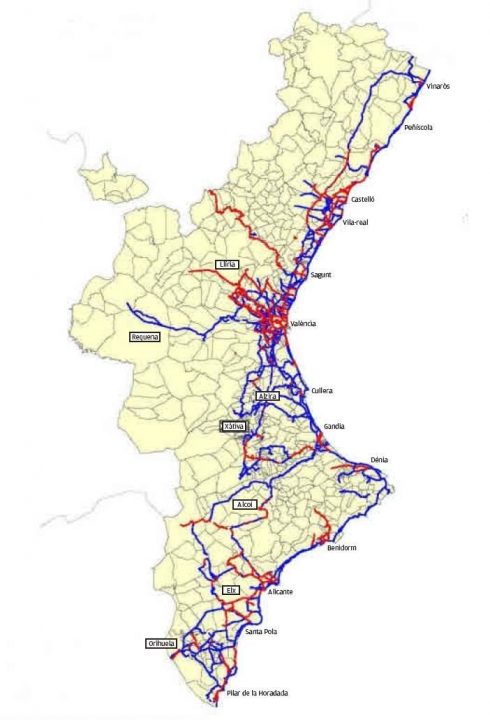
Some 3,360 kilometres of track (2,100 miles) will stretch from Vinaròs in Castellon to Pilar de la Horadada in the south of Alicante province.
Currently, cycle routes number 199 and with a total distance of 1,017 kilometres (636 miles). Paths range from the 300m of cycle lane in a roundabout in Novetlè to the 76km track of the Greenway of Ojos Negros, the longest in Spain.
Now, a Valencian objective called PAT (Plan de acción territorial de carácter sectorial or territorial action plan of a sectoral nature) aims to improve that further.
The XINM (Network of Non-Motorized Itineraries of the Valencian Community) has recognised that so many paths are still unconnected, claiming continuity could not be guaranteed, due to the immediate surroundings in certain areas.
The new plan is designed to make improvements in five key areas:
- Complete existing cycle routes
- Connect previously-unconnected areas
- Facilitate daily mobility
- Promote recreational mobility
- Permeabilization of infrastructures
The long-term plan is to connect this Valencian network with long-distance recreational and tourist routes such as Eurovelo EV-8 (the trans-European route from Cádiz to Greece).
READ MORE: Cycle lanes between popular expat town and local beaches mooted for Spain’s Costa Blanca