
FORMENTERA DEL SEGURA became the last of the 27 municipalities in the flood-hit Vega Baja region to be assessed.
The town has received almost half a million euros for work on sustainable drainage systems that were tested during the September 2019 gota fria and subsequent floods.
The funding came from the Plan Vega Renhace del Consell, with its director Antonio Alonso, confirming figures with the mayor of Formentera del Segura, Francisco Cano.
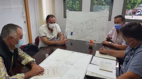
Alonso has now completed his round of all the region’s towns, listening to demands and coordination action plans in the lowlands of southern Costa Blanca.
The long term goal is to turn the Vega Baja into a flood-resistant territory ahead of further gota fria or floods in the future.
In Formentera specifically, the project involves the placement of floating barriers in the streets and ditches of the neighbouring Segura river.
Also, Sustainable Drainage Systems (SUDs) are being installed, part of the Spanish government’s €16m nationwide plan.
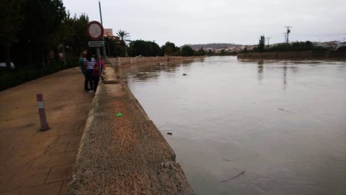
PHOTO CREDIT: Olive Press Spain
A “floodplain park” is planned for an area just outside the village, to enable excess rainwater in low-lying areas to be collected and pumped into the drainage network of Los Palacios, a neighbourhood in Rojales that still forms part of Formentera municipality.
Luckily for Formentera, the village suffered none of the devastation that was suffered by neighbouring towns during the September 2019 storms and floods, although the Segura river did swell to an alarming level.
Interestingly, the Vega Baja (low lands) was originally a huge inland sea that was part of the Mediterranean in Roman times, with most of the towns and villages sitting on what is effectively compacted sediment from the Segura river itself.
Islands in that sea and other higher grounds (that didn’t flood in September 2019) include La Marina Urbanisation, Benijofar and further north, Santa Pola.

The meetings throughout the region’s towns began in February, but have taken until now to complete due to Covid-19 restrictions.
In total, they have visited: Albatera; Almoradí; Benferri; Daya Nueva; Daya Vieja; Guardamar del Segura; Jacarilla; Los Montesinos; Orihuela; Pilar de la Horadada; Rafal, San Isidro; San Miguel de Salinas; Torrevieja; Algorfa; Catral; Callosa de Segura; Benejúzar; Pains; Benijófar; Bigastro; Cox; Rocamora farm; Redován; Rojales, San Fulgencio, and now Formentera del Segura.
READ MORE:
– EXPLAINER: On second anniversary of killer floods on Spain’s Costa Blanca, we explain the gota fria and how to stay safe
– Roman map shows flood-hit regions of the Costa Blanca were part of the Med just 2,000 years ago